

From the National Weather Service (NWS) Grand Rapids:
A winter storm watch is in effect for Calhoun and Jackson Counties from Wednesday afternoon through Thursday morning.
- Heavy mixed precipitation possible. Total snow accumulations between 5 and 7 inches and ice accumulations around a light glaze possible.
- Travel could be very difficult. The hazardous conditions could impact the Wednesday evening and Thursday morning commutes.
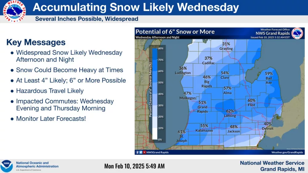
From Wednesday mid-day to Thursday morning, accumulating snow is likely across much of the Lower Peninsula. Generally 4 to 8 inch totals are possible. Snow may fall up to 1 inch per hour Wednesday evening, slowing down travel speeds substantially and increasing your chance of getting stuck in a slide-off. Thursday is the “dig-out day.” Temperatures will be in the 20s to teens, and wind chills (feels like) in the teens to single digits.
Stay tuned to WKHM for the latest developments.